
Note the massive curtains to the left and right of the limestone pillar. This location, somewhere in East Tennessee, is purported to be a full two miles underground.
Note the massive curtains to the left and right of the limestone pillar. This location, somewhere in East Tennessee, is purported to be a full two miles underground.
Some of you may remember the crack cocaine epidemic bequeathed to the city of Los Angeles during the 1980s by the Central Intelligence Agency, exposed by Gary Webb in his series, Dark Alliance. You can read more about this fascinating story here.
The same thing was happening on the other side of the United States, in St. Louis and Detroit, thanks to organized crime centered in and around London, KY. The CIA was monopolizing on addiction and using the proceeds to fund covert wars in places like Cuba, Nicaragua, and southeast Asia. Little did Gary Webb realize, the coal conspirators he wrote about in eastern Kentucky in his “Coal Connection” articles, would ultimately fuel the same drug epidemic in Detroit and St. Louis that he found in Los Angeles, and wrote about in “Dark Alliance.” The Kentucky alliance still involved coal conspiracies, but now different contraband: instead of stolen bulldozers and strippers, it was pot, cocaine, quaaludes, and weapons.
Octavio Pino was a Cuban national who had relocated from Miami to southeast Kentucky when he was arrested by the feds along with 12 others for drug trafficking in the early ’80s. The October 10, 1982 issue of the Corbin Times Tribune states, “The 13 were arrested…during simultaneous drug raids in Kentucky, Tennessee, Michigan and California. The FBI charges that Pino set up a bogus coal company in London as a front for the drug operation.”
A February 13, 1983 article printed in the Corbin Times Tribune illustrates the impact this criminal outfit had on the streets of Detroit:
Records of the [front] company did not reflect any coal-related business, the FBI said. A Detroit television station sent an investigative news team to London shortly thereafter because the London based operation was believed to be a major supplier of cocaine to the Detroit area, according to the news director of the station.
Then there is this 1983 excerpt from Vance Mills’ FBI file stating, “captioned suspects are significant traffickers with impact of southeastern Kentucky area as well as the area of St. Louis, Missouri.”

The CIA aspect of these alliances make this tale so sick, so twisted, most Americans are unwilling to believe their government could take part in something so heinous. Gary Webb’s “Coal Connection” had morphed into the Bluegrass State’s own twisted “Dark Alliance,” except instead of decimating the streets of Los Angeles, these rats from the Commonwealth infected St. Louis and Detroit with their poison, not to mention east Tennessee and southwest Virginia.
When I asked my confidential source (mentioned earlier) if Jimmy Renfro was CIA, he paused for a moment then said, “Well, knowing Jimmy….” letting his voice trail off. He then divulged his own work as a contractor for the CIA. I find his non-committal answer concerning Jimmy Renfro a good reason to believe Renfro was a CIA asset, but that is just a very educated guess.
Could Octavio Pino also have been a CIA asset? I often find myself wandering back to David Beiter’s WORMSCAN files and marvel at his ability to log an incredible amount of information concerning Kentucky corruption into one easily searchable place, found here. David Beiter was clearly fearless. He deserves much credit for the WORMSCAN files compilation.
One of his logs reads as follows:
871100, "The Contra-Drug Connection", The Christic Institute, 1324 North Capitol Street, NW, Wash DC 20002. (202)797-8106. $2. 12p. Extensive documentation associates several of Oliver North's team with large-scale drug trafficking to finance covert wars in Cuba, Southeast Asia, and Central America, for over two decades.
Pino was a Cuban national intimately involved in the smuggling of narcotics from Columbia to the United States, something which he had already been busted for in the early 1970s. It is a legitimate question to ask if Pino’s activities (and Mills’ and Renfro’s) were being backed by the CIA at the time.
A March 20, 1983 Times-Tribune article states:
“Fifteen people originally were charged in the FBI breakup of an alleged interstate drug [ring] operating out of London in 1981 and 1982. Gill, senior resident agent in the London FBI office, said the investigation of the drug ring began in September 1981 on an informant’s tip. After an initial investigation at the London-Corbin airport, Gill said they realized the investigation ‘would be a sensitive matter in the community.‘”
Just like Barry Seal and Drew Thornton’s ties to the CIA, the FBI states Vance Mills and his pilot (most likely referring to Johnny Martin) “appear to have access to otherwise confidential information through the various airports that he frequents…” and a Corbin Times Tribune article from September of 1982 states, “‘Pino and other Cubans were flying in and out of the London, Ky., airport to and from distant locations on odd and erratic schedules using high performance aircraft.’ The document said those flights were conducted without clearance by the Federal Aviation Administration.”
Classic CIA. Inslaw’s Promis software. These fellows had advance knowledge of law enforcement operations occurring at any given airport. These are not your run-of-the-mill drug traffickers. They had intelligence available to them only law enforcement could provide.
What if I told you this same criminal ring would eventually be tied to another software program containing all locations of all pharmaceutical shipments from manufacturer, to shipper, to warehouse, to end user, all in real- time? Are you finally starting to understand the truth of who has been in control of your law enforcement and courts for over forty years or more? Do you recognize those persons responsible for the scourge of drug-fueled misery hoisted upon your kids and community?
The following excerpt is from my own personal journal detailing an encounter that happened to me at the Shell gas station on Cumberland Avenue in Middlesboro back in the winter of 2014. While the area intrigued me, I had not yet started this blog, or any research into the topics mentioned in it. I was comparatively new to the area, only having lived here a couple of years. The conversation was interesting enough I wrote it down. I had no idea how glad I would be later that I did:
A man comes in to pay for his gas. He is wearing a flight jacket that says "P38 ICE PLANE LOST SQUADRON" and I say, "Oh, are you one of the ice plane guys?" He smiled and said, no, he got the jacket off a good friend, (redacted). Then he mentioned he was a pilot and that he flew search and rescue for the Air Corps, and was also in the military. He said he was so young when he went to get in the military he had to get his father's permission. His dad said, " You can go if you want to, but don't call me to come get you out." When he got out of the service, he said, "They wanted me to go into the CIA." Of course I said, "What did you say?" He just smiled and didn't answer. So I finally said, "You can't tell me, can you?" He just smiled again. When he was telling me about his flying experience he said he could fly anything but a jet.
This encounter bolsters my belief the CIA has been widely active in southeast Kentucky for decades, most likely because of the efficacy of which they operate thanks to corrupt law enforcement, courts, business leaders, and a largely drug-addicted and therefore apathy-induced populace.
A few years ago I got to experience a special secret very few know about in the southeast Kentucky-southwest Virginia-eastern Tennessee region: a very old mine hidden by decades of grown up brush cut into the rock of Cumberland Mountain. I have no idea who owns the property now, but I will re-tell the story as it was told to me by the owner at the time. (Names are changed in the interest of protecting privacy.)

The property owner’s neighbor, Cédric, worked the mine decades ago. He claimed there was a seam of silver that was discovered to rise one inch a foot back in the mountain, and the seam went on for miles.
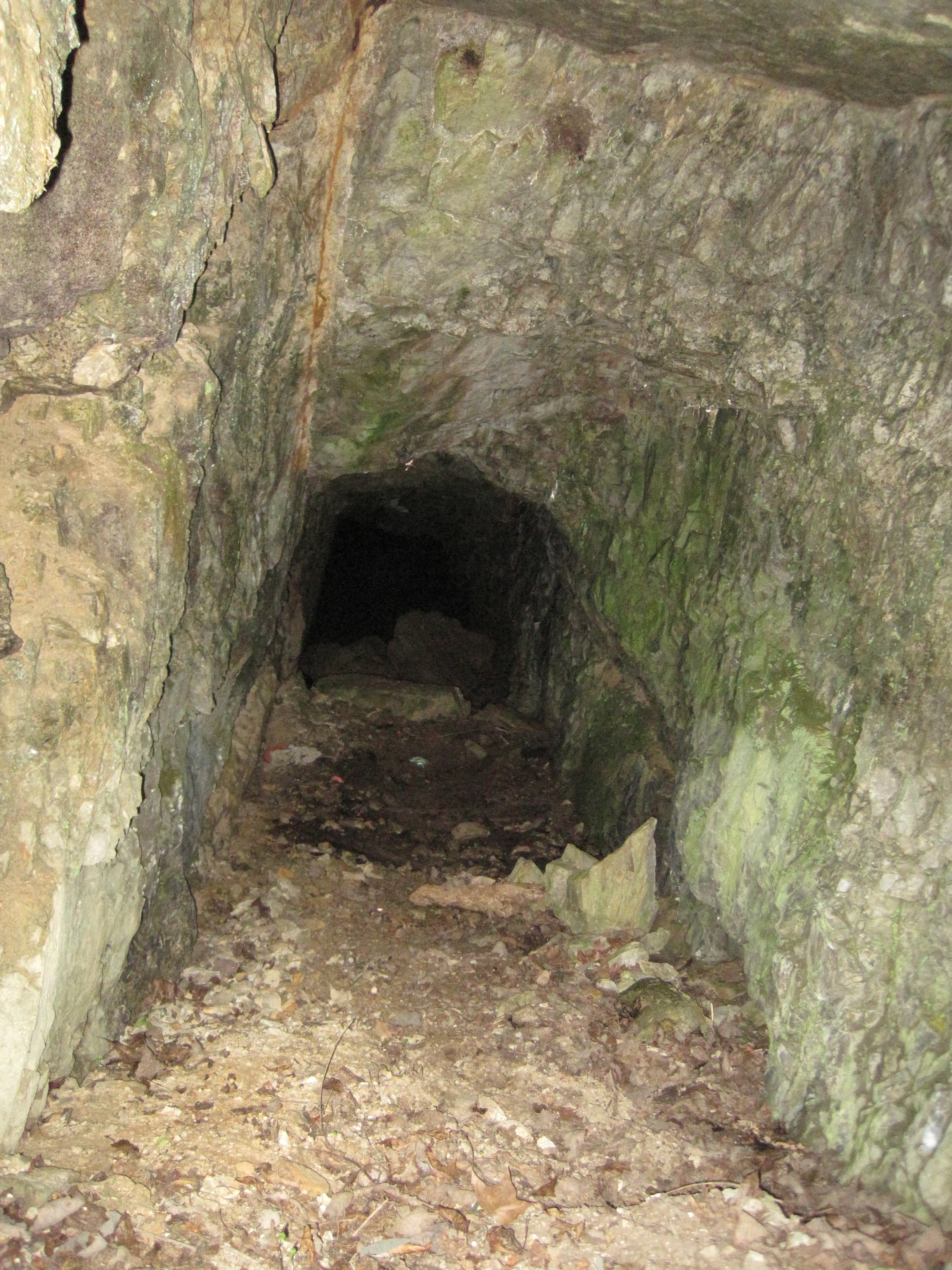
The mine was being worked in approximately the 1930’s. Whether the ore being mined was silver or another type of valuable material, it was special enough that the miners placed the ore into wooden boxes before carrying it out of the mine and loading it into covered trucks, as if to keep the material being mined a secret. It was even more mysterious that the covered trucks waited until the cover of night had settled in to travel to their destination, never leaving the mine before midnight.
One night, the mysterious miners packed up and left without explanation. No one ever came back until approximately 20 years ago, when the owner received a sole request for permission to re-open the mine, a request which he denied.
Cédric, the old neighbor who had worked the mine, was rumored to have possessed a special healing ability. If a person got hurt and was bleeding bad, all someone had to do was tell Cédric and he could stop the bleeding, whether the person was in his presence or not.
The owner himself lived in the same valley as a child at the time the mine was being worked. He disclosed that he, his brother and father saw what he reported as a “searchlight in the sky, making a big, wide circle around them.” They witnessed this light several times in the night sky during the 1930s and 1940s.
UPDATE: November 1, 2019
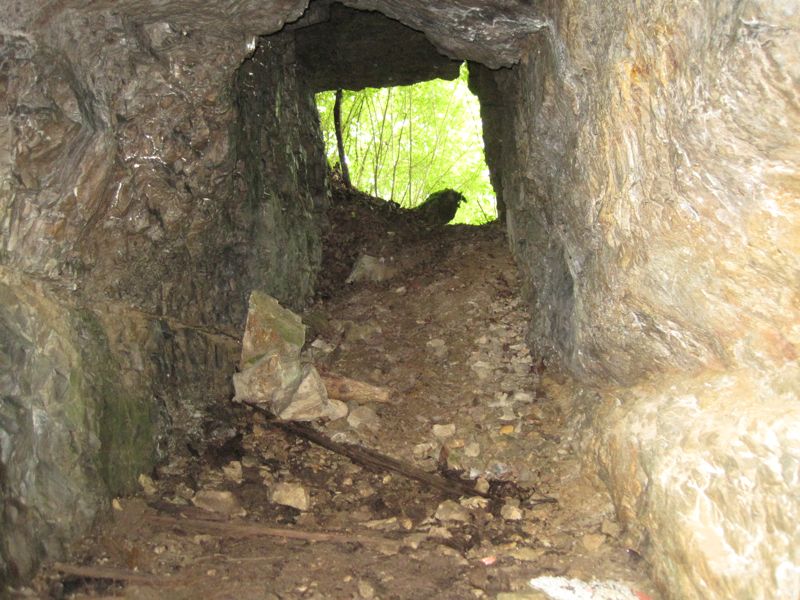
Ronald, a reader in Arkansas, wrote in recently about an old mine he found in his state that bears a striking resemblance to the one pictured above. Below is his photo and story:

“Hi. I found an almost identical mine shaft here in Arkansas. Legend has it that a man named Tobe Inmon came from Kentucky and made bullets from lead he mined in nearby hills. As it turns out, the lead was actually silver. People around here have been looking since the late 1800s and I recently found it. Notice the similarly in shape and size…”


The National Security Archive at George Washington University, Electronic Briefing Book No. 268 states:
“…two U.S. presidents dealing with the Shah of Iran, Ford and Carter, put concerns over proliferation and the Shah’s possible desire to build a nuclear bomb front and center when they approved negotiating positions for a deal to sell nuclear reactors to Iran.” (1)
We’re told the Iranian Revolution of 1979 killed the deal- but did it?
November 4, 1979: 52 Americans from the U.S. Embassy in Tehran were taken hostage, and held for 444 days. Remember, up until this crisis and the revolution, plans had been made to sell nuclear reactors to Iran.
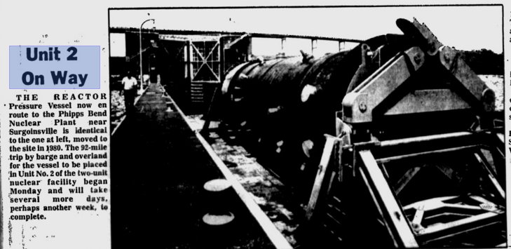
Is it possible the U.S. was pressured to honor the original agreement? Did we send the second missing Phipps Bend reactor pressure vessel to Iran in order to secure the hostages’ release? We are given the fake news article about its arrival in Phipps Bend in June, 1981:
 (2)
(2)
The Chicago Iron and Bridge worker interviewed in May of 2016 said he wasn’t sure what ultimately happened to the second vessel, but he did know it had not been sent to Phipps Bend. He said, “several RPVs were being stored onsite in Memphis” at the time.
Sending a nuclear reactor to Iran wouldn’t have been the most popular move an already unpopular President could have made. If this did happen, it well explains the lies and secrecy fed to the American public concerning the second reactor.
In 1957, The United States and Iran signed the Atoms for Peace nuclear cooperation agreement:
“…an agreement that provides for technical assistance, the lease of several kilograms of enriched uranium, and cooperation on research on the peaceful uses of nuclear energy.” (3)
In 1967, the Tehran Nuclear Research Center is built:
“It has a 5-megawatt pool-type thermal research reactor supplied by the United States and is to be operated by the Atomic Energy Organization of Iran…(In November) the reactor at Tehran Nuclear Research Center goes critical, using 93 percent enriched uranium supplied by the United States.” (3)
In the article, “How Iran became a “Nuclear State” by Jeremy Bernstein, the author states:
When the TRR (Tehran Research Reactor) initially needed new fuel elements it was shortly before the 1979 revolution, and the Iranians chose simply to replace the TRR with a new, safer model of reactor designed in part by Freeman Dyson and manufactured by the San Diego firm General Atomics, which they ordered and paid for. Before it could be delivered, however, the revolution came and General Atomics’ export license was revoked. (4)
Iran has now paid for a nuclear reactor it appears they won’t receive, in addition to paying an additional $400 million to the United States for military equipment prior to the 1979 uprising. But the nuclear reactor they paid for back in 1979 was never brought up again. Was this reactor a secret part of the 1980-1981 hostage negotiations?
“The major issue between the two governments was a $400 million payment for military equipment made by the government of the Shah of Iran, prior to the 1979 uprising that toppled him. The U.S. banned delivery of the jets and other weapons amid the hostage crisis, but froze the $400 million advance payment.”(5)
Notice the issue of the paid-for reactor they (supposedly) did not receive is not mentioned.
The Barack Obama administration repaid the $400 million 35 years later…in addition to $1.3 billion in interest. This payment happened to coincide with a new nuclear agreement with Iran and another hostage release, the five Americans held in Tehran:
The White House repeatedly insisted that the nuclear deal must be kept a separate issue from the cases of the detained Americans, but the nuclear talks have helped significantly open up avenues of communication between the two countries that had been little used since the U.S. cut ties in 1980. (6)
It’s almost as if Iran has learned how to make the United States keep its nuclear promises.
(1) The National Security Archive. “The Nuclear Vault: U.S.-Iran Nuclear Negotiations in 1970s Featured Shah’s Nationalism and U.S. Weapons Worries.” Burr, William., Jan. 13, 2009.
(2) The Kingsport Daily News. “Unit 2 on Way.” June, 1981.
(3) Iran’s Weapons of Mass Destruction: the Real and Potential Threat. Cordesman and Al-Rodhan. The CSIS Press (Center for Strategic and International Studies.) 2006.
(4) “How Iran became a ‘Nuclear State.'” Jeremy Bernstein. The New York Review of Books. Feb. 19, 2010.
(5) “5 Things You Need to Know About the $400 Million America Sent to Iran.” Fortune.com. Shawn Tully. Aug. 5, 2016.
(6) “Iran releases 5 detained Americans, including Washington Post reporter.” Nahal Toosi. Jan. 16, 2016. Politico.
Documents indicate Chicago Bridge and Iron Nuclear fabricated the two massive reactor pressure vessels in Memphis Tennessee. Unit 1 traveled by barge to Knoxville, where it continued on to Phipps Bend in a slow, widely publicized procession. There is video as well as photographic evidence of this event.(1)
We have no proof Unit 2 ever arrived to Phipps Bend.
Other nuclear reactor pressure vessels have travelled less conspicuously by water, not using overland transportation. The Journal News of White Plains New York reported a similar vessel travelled by ship to New Hampshire’s Seabrook nuclear plant. No roads were closed. No powerlines raised. No bridges reinforced. No traffic diverted. No miles of onlookers to gape at the monstrosity as it crawled slowly down the road.(2)
Let’s go back to the last known location of this missing reactor pressure vessel. Unit 2 was being built at North America’s largest waterway- the Mississippi River. The Arkansas River is a major tributary of the Mississippi, and just as easily traversable by barge. The Arkansas River leads straight to the Ozarks and the Ozark National Forest, where there were numerous reports the federal government was building an H-bomb plant there.
The underground topography in the Ozark area is quite similar to that of northeast Tennessee, southwest Virginia, and southeast Kentucky. Karst/limestone landforms, especially caves, many large and miles long, are abundant in the Ozarks.
Consider the following article written by Inez Robb for Assignment America:
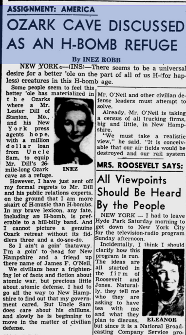
There seems to be a universal desire for a better ‘ole [hole] on the part of all us H-(for hapless) creatures in this H-bomb age.
Some people seem to feel this ‘ole has materialized in the Ozarks where a Mr. Lester Dill of Stanton, Mo. and his New York press agents hope, with a million dollar loan from Uncle Sam, to equip Mr. Dill’s 26-mile-long Ozark cave as a refuge.(3)
Another editorial, Our Daily Bread, opines:
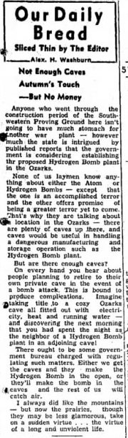
Anyone who went through the construction period on the Southwestern Proving Ground here isn’t going to have much stomach for another war plant–however much the state is intrigued by published reports that the government is considering establishing the proposed Hydrogen Bomb plant in the Ozarks.
None of us laymen know a thing about either the Atom or Hydrogen bombs except that the one is an accomplished terror and the other offers promise of being a greater terror yet to come. That’s why they are talking about a location in the Ozarks–there are plenty of caves up there, and caves would be useful in handling a dangerous manufacturing and storage operation such as the hydrogen bomb plant. (4)
Of course, other sites were also in the running for this proposed H-bomb plant. It seemed that power generation for the proposed Ozark site was a concern to President Truman:

President Truman told Arkansas congressmen James Trimble and Wilbur Mills plainly:
…power supply is the determining factor, and to be very blunt about it, there have been some very shortsighted men in your state. They have deliberately held up vital power projects which are now essential for this plant.(5)
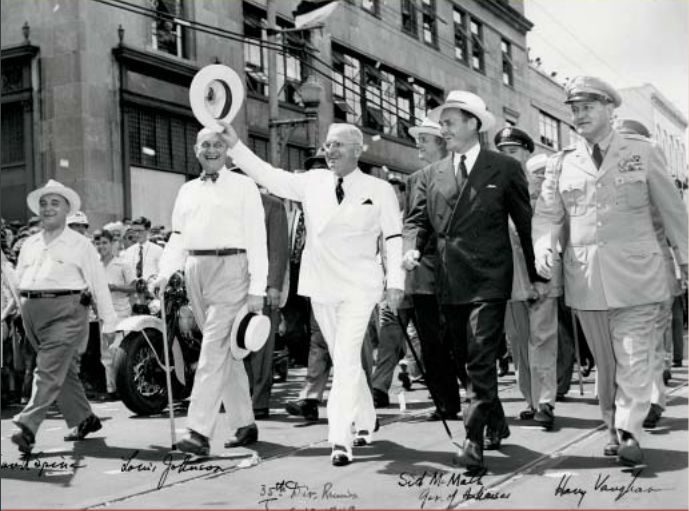
By 1952, President Truman was dedicating and touring two new hydroelectric dams in Ozark territory in Northern Arkansas. It would seem any concern with lack of sufficient power for the plant had been more than addressed.(6)
Just as I theorized the official announcement they had chose Alabama as the site for the nation’s future nitrate plant was disinformation to direct attention away from a secret facility at Cumberland Gap, so I wonder if the final announcement that South Carolina would get the H-bomb plant was also disinformation, intended to protect a secret facility located deep in the Ozarks?
From The Tennessean, July of 1981:
TVA leader [Charles] Dean said recently he believed the Defense Department should help fund construction of the nuclear plants so the power could [be] used to build atomic submarines.(7)
Did the 2nd missing Phipps Bend RPV ultimately become part of a secret nuclear submarine facility somewhere in northern Arkansas?
I interviewed a former worker for Chicago Bridge and Iron Nuclear, and he confirmed the second vessel was never shipped to Phipps Bend. He thinks it may have been cut up for scrap, but he cannot say for sure. He said at the time, several RPVs were being stored on site in Memphis.(9)
I followed the footsteps of a second Chicago Bridge and Iron Nuclear worker, whose specialty was reactor pressure vessels. One year after the completion of the second Phipps Bend RPV, he left CB&I to perform inspections on a new power plant construction (1982). The name of the plant is not indicated. Then for the next thirty years he is a senior project manager with a large, worldwide nuclear services outfit. The only problem is, this nuclear outfit has no facilities anywhere near this gentleman’s home base: Jonesboro, Arkansas. Jonesboro is approximately 60 miles from the Ozarks.
Interestingly, I found several career listings in Bay, Arkansas, for mechanics to support nuclear weapons security missions. Even though the jobs are listed under Arkansas (not far from Jonesboro), it indicates applicants will be at the Naval Submarine Base Kings Bay, Georgia. The company behind the job listings does not appear to have any facilities in the Bay, Arkansas area. So why are the jobs listed geographically for the Ozark region?
Consider the following newspaper article from May of 1942:
In July 1951, Congress authorized the first nuclear submarine to be built.
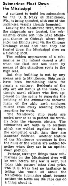
There was already a naval submarine plant accessible to the Mississippi River in Manitowoc, Wisconsin.(8)
Could the Mississippi River and the Ozarks be part of a production line for the construction of naval nuclear submarines? Compartmentalization is key to the success of government defense programs. 1.) Construct the submarines at one location. 2.) Build their power supplies at another. 3.)Store/produce weaponry at another location 4.)The submarine travels down the production line until completed and ultimately sent to its destination.
The idea that there is a supply chain across the eastern United States for our nuclear naval submarines was first presented to me by a colleague. I cannot claim credit for this theory. This colleague went through great hardship attempting to ascertain the truth; understandably, he may not want to return to this research. But he does deserve recognition for this theory, even if I cannot identify him by name. Thank you, W, and I’m very sorry for what you went through.
(1) “Outdoors” by Mark Aldeen. Daily News. March 18, 1977.
(2) “Atomic power protest ends in 180 arrests.” The Journal News. March 10, 1979.
(3) “Ozark cave discussed as an H-Bomb refuge.” St. Petersburg Times. March 22, 1950.
(4) “Our Daily Bread.” Alex Washburn, editor. Hope Star. August 19, 1950.
(5) “Choice of H-Bomb site narrows to three.” The Evening Independent. August 16, 1950.
(6) “Presidential Pathways.” arkansas.com.
http://www.arkansas.com/!userfiles/presidential_pathways.pdf
(7) “TVA stall in curbing N-program reported costing $2-$4 billion.” The Tennessean. July 31, 1981.
(8) “Submarines Float Down the Mississippi.” The Montana Standard. May 28, 1942.
(9) Personal phone conversation. Source identity protected. May 17, 2016.
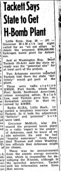
 Many dismiss the theory that the federal government would place a nuclear facility within a national park. After reading the 1950 newspaper article at left, I am even more convinced there could be such a facility at Cumberland Gap National Park.
The above article is taken from the Hope Star, an Arkansas newspaper, in August of 1950. Congressman Boyd Tackett has indicated that northern Arkansas would get an H-bomb plant. Although there is no formal announcement from the Atomic Energy Commission, Tackett said “his information came from that source.” Tackett said “the plant would be situated either in the Ouachita National forest or the Ozark National forest.”
Tackett said, “Arkansas has been selected as the proper area…because it has the necessary requirements.”
This story echoes the story of the munitions facility I believe was constructed at Cumberland Gap; the experts recommended the best suited place for the plant yet, in the end, their advice was supposedly unheeded.
The following article details the region’s frustration:
“Several months ago it was announced the government would build a large hydrogen bomb plant in the heart of the Ozarks…It was pointed out the plant would be located in the interior of the country, safe from possible attack from either coast. It would not be possible, it was declared, for an enemy plane to penetrate that far into the interior, or to inflict important damage on this important facility.
But the plans have changed, and instead of being located in this comparatively safe region the plant is to be built in the Savannah Valley, only minutes by air from the Atlantic coast. The proposed plant would be an easy target for enemy bombers.” (2)
The author laments that “politics” were the reason the plant location was changed; the Democratic party needed their southern voter numbers up. The author believes this was a move to win favor with those voters. I vehemently disagree. The likelihood the plant was installed there all along is a reasonable theory.
Just as President Wilson possibly visited a secret munitions facility at Cumberland Gap in 1918, did Truman visit a newly completed nuclear facility hidden in the Ozarks in 1952?
(1)”Tackett says state to get H-bomb plant.” Hope Star, August 26 1950.
(2)”Party must be served.” Terre Haute Star. December 14, 1950.
(3) “Presidential Pathways.” arkansas.com.
http://www.arkansas.com/!userfiles/presidential_pathways.pdf
There are some eye-raising National Park Service water quality reports from the 1990s concerning Gap Creek, which flows through Cudjo’s Cave (or, Gap Cave).
Chromium was found in the creek in measurements up to 70 ug/L (which is equivalent to 70 parts per billion) between the years 1991 to 1996.(1) This is nearing the EPA’s maximum contaminant level (MCL) for chromium in drinking water, which is 100 ppb.
The National Park service tells us that:
Rivers once flowed through the upper chambers of Gap Cave–and Gap Creek still flows through the lowest level of the cavern. Water flowing from the cavern was used to power several mills and the machinery at the Cumberland Iron Furnace in the 19th century. The creek was dammed inside the cave in the 1800’s to create a reservoir that still supplies the towns of Cumberland Gap and Harrogate, Tennessee with drinking water.(2)
When contaminant levels are approaching the maximum levels set by the EPA, and the water supply is a source of community drinking water, it would be reasonable to expect the continued monitoring of contaminant levels in Gap Creek. However, Jennifer Beeler, the Cumberland Gap National Park’s Resource Management Specialist, indicated the water quality reports stopped when the Tunnel construction ended:
That work was done during the tunnel construction with funding from that particular construction project. After the tunnel was completed that degree of funding for water quality work was no longer available. We do basic water quality work each month like e. coli, temp, dissolved oxygen, conductivity, ph, turbidity etc, but that is it right now.(3)
Remember when the Middlesboro Tannery was blamed for chromium found in Yellow Creek? Interestingly, it would have been impossible for the tannery to contaminate Gap Creek:
Gap Creek on the TN side of the park comes from Gap Cave, flows through the town of cumberland Gap than Tiprell and then eventually empties into the Powell River. Little Yellow Creek in the park goes into Middlesboro, flows into Yellow Creek and then eventually into the Cumberland River. So the two are not connected at all.(3)
Another possible contaminant of concern in Gap Creek is manganese. Overexposure can be responsible for symptoms similar to Parkinson’s Disease, most notably muscle tremors and other neurological damage. Manganese toxicity can also be misdiagnosed as Lou Gehrig’s disease or multiple sclerosis. Children are especially susceptible to manganese toxicity. Currently, the EPA has established a “health advisory level” of .3 mg/L, or, 3 parts per million. However, in 1996, a report by the EPA,
in developing an oral reference dose for manganese based on dietary intake, mentions an epidemiological study in Greece that showed an increase in neurologic effects such as weakness and fatigue, disturbances in gait, and neuromuscular effects, in people whose drinking water contained 1.6 to 2.3 mg/L.(4)
The water quality reports for Gap Creek, where the communities of Cumberland Gap and Harrogate obtain their drinking water, show up to 210 parts per billion, or, .21 mg/L on December 1, 1991 and 270 parts per billion, or, .27 mg/L, manganese on March 23, 1993.(1)
(1) STORET Central Warehouse, EPA.
https://ofmpub.epa.gov/storpubl/storet_wme_pkg.Display_Station?p_station_id=CUGA_CPSU_GC4&p_org_id=11NPSWRD
(2)Cave Handout, National Park Service.
https://www.nps.gov/cuga/learn/nature/upload/cave-handout2.pdf
(3) Email communications, June 23 2015, with Jennifer Beeler, National Park Service.
(4) Drinking Water Notification Level for Managanese, California EPA State Water Resources Control Board.
http://www.waterboards.ca.gov/drinking_water/certlic/drinkingwater/Manganese.shtml
The following was written by a guest author who wishes to be known only as The Mysterious Man from Rose Hill. We’ve decided to name this huge underground cave “The Airplane Room” in memory of his father.
This is a story that was told to me by my father when I was 8 to 10 years old in the late 50’s. It was an exciting story for a young boy and I still have vivid memories of him telling it.
Please understand that everything I’m relating is hearsay as I have no way to verify or corroborate the account. My father was a very truthful person. In fact he would often admonish me as a child to never exaggerate or embellish a story. “If you stretch the facts, then no one will believe you when you do tell the truth,” he said.
Following is a recounting of the story as told by my father, as I remember it:
The setting is in Cumberland Gap, Tennessee where my father lived with his family. The time is the early 40’s. It was the war years, and my Dad was in his early teens.
One night, Dad and two of his friends decided to go exploring in Gap Cave, known at that time as Cudjo’s Cave. Arriving late at night, after everyone had gone home, they entered the cave and began their exploration to see how far they could travel inside the cave. After making their way through rough terrain, narrow passages, small openings, mud and water for nearly half the night, they were surprised to enter a huge room much larger than anything they could have imagined.
“We were so excited to have made this amazing discovery,” Dad said, “And to think we were the first people to see it.”
I said, “Dad, how did you know that you were the first people to discover it? How did you know no one else had been there?”
He said, “Well, when we first went in that big room, there was water dripping everywhere. The water had puddled on the floor, and on top of the water, minerals had hardened like a thin sheet of ice on a pond. Where we walked, we broke through the crystal, just like breaking though thin ice, and it left our footprints visible. When we first went in, there were no other footprints, so we knew we were the first.
“Dad,” I said, excited, “just how big was this room? How many feet across?!”
“I don’t know exactly,” he said, “we didn’t have anything to measure with, but I know how big a football field is, and you could put several in it.”
“How many?” I asked.
“Well, several, ” he said.
“Dad, could you see all the way across from one side to the other? Was the ceiling high enough to see the walls all the way around?”
“Oh yeah, he said, “it had a high ceiling.”
“How high would you estimate?”
He said, “Well, it was high enough that you could fly an airplane around in it!”
“Dad,” I asked, “could you fly a passenger plane in it?”
“I don’t know about that,” he said, “but there’s plenty of room to fly a small two-seater plane around inside!”
“Could a small plane take off in that room?” I asked.
“No,” he explained, “the floor is not smooth enough. There are big boulders strewn across the floor. We thought that, in time, there must have been an earthquake and part of the ceiling must have fallen.”
“Do you think that room might ever be open to the public?”
“I doubt it,” he said. “It’s too far back in the mountain and too hard to access. Some of the openings are very small.”
“How long were you there exploring?”
“Not too long,” he replied. “It was a long trek to get there, and we had to be out before morning.”
“Dad,” I asked, “did you carve your names and a date, so people would know you were there?”
“No, he said, “we didn’t do that.”
“Dad, if I ever had a chance to explore that cave, is there any way I could know you were there?”
“Well…” he thought, “we did leave one thing behind. We noticed how heavily everything was mineralized, and we wondered how long it would take for the mineralization to occur. We left a coke bottle under a dripping stalactite thinking that we might come back some day.”
“Dad, how did you get inside the cave?”
“Well,” he said, “there are several ways to get in, but that’s a story for another time, and I have a hard day tomorrow. It’s bedtime and we’d better turn in.”
Back in the eighties, a Middlesboro, Kentucky tannery that processed leather hides was under fire as perpetrators of massive pollution in Yellow Creek.
A Middlesboro Daily News article dated April 8, 1990, “Yellow Creek: Microcosm of environmental movement,” states high levels of chromium were found in the creek bed of Yellow Creek in 1987:
A study by a University of Louisville chemist discovered the pockets of chromium, a byproduct of the tannery process that can cause cancer.
and
Three health studies of [Yellow] creek residents investigated elevated rates of cancer, leukemia and intestinal problems. (1)
Chromium use in the Middlesboro Tannery began in 1965. Dr. Lorann Stallones research, “Final Report on Cancer Mortality in Bell County 1979-1985” indicates
Two studies performed in the early 1980’s reported waste waters flowing through and being discharged from the [sewage treatment plant] were highly toxic to aquatic life….the actual cause of toxicity was not determined….(13)
The first study (that I can find) that shows deposits of chromium in Yellow Creek occurred in 1984, coincidentally after the Three Mile Island cleanup began:
Settleable solids deposited in Yellow Creek were shown to contain chromium, copper, nickel, lead and zinc. (13)
In defense of the Middlesboro Tanning Co.,
Dirk Anderson, manager of the Middlesboro Tannery Co. , says it ‘has done an excellent job in meeting state and federal guidelines’ and ‘installed the most efficient pretreatment system in the tanning industry today’. (15)
Could the federal government have asked the tannery to accept contaminated water from Three Mile Island under the pretense the tannery’s pretreatment system could handle it? Remember- the tannery’s pretreatment system was designed to deal with chromium in the wastewater. Did officials think it could also “pretreat” the chromium from the contaminated water at Three Mile Island? If so, were Middlesboro officials aware of it as well? Remember, there had never been a nuclear disaster of this proportion before Three Mile Island. I could just imagine the panic, and mistakes that most likely were made.
Or, could the chromium in Yellow Creek possibly have trickled out of Cumberland Mountain from buried nuclear waste? Research carried out by Zachara et al. tells us this very thing occurred at another nuclear facility where waste was being stored, the Hanford nuclear site:
Chromate (hexavalent chromium as CrO42-) is a significant groundwater contaminant at the U.S. Department of Energy (DOE) Hanford Site in southeastern WA.
and
Chromate in ground water is readily transported through flood deposits…resulting in groundwater contamination plumes…”(2)
Interestingly, there continues to be elevated amounts of chromium in the eastern Kentucky water supply, even after the environmental cleanup of the tannery and Yellow Creek. This is evidenced in the Division of Water’s report, “Potentials for Levels of Arsenic and Chromium in Drinking Water Contribute to the Higher Cancer Rates Found in Eastern Kentucky as Compared to the Rest of the State.”(11)
Sobering data from the Environmental Protection Agency shows elevated levels of chromium in Gap Creek and its tributaries within the town of Cumberland Gap as well as the National Park. See STORET’s data here.
In addition to the the continuing presence of chromium found in the creeks, tributaries and water supply, a nuclear waste site upstream would explain the sicknesses reported by those living downstream: eerily, they match the same ailments as radiation poisoning. The National Institutes of Health states:
The bone marrow and gastrointestinal tract are especially sensitive to radiation injury…(3)
The Center for Environmental Health studies continues:
Strong evidence has been recorded of a possible connection between forms of leukemia and exposure to ionizing radiation. …These findings are consistent with the National Research Council’s determination that radiation can cause acute leukemia and chronic myeloid leukemia.
In a Los Alamos Science piece, “Low-level radiation: How harmful is it?” author Roger Eckhardt points out
Nearly all tissues and organs of the human body are susceptible to radiation-induced cancer….Leukemia was at one time thought to be the principal type of radiation-induced cancer; however, solid cancers, such as lung, breast, and thyroid cancers, are the more numerous result…(4)
Remember the Department of Defense sponsored lung cancer study?
In 2011, Arnold and her colleagues were awarded a $1.43 million grant by the Department of Defense to study potential environmental reasons — such as trace elements in soil or water — for the high lung cancer rates in Eastern Kentucky.
“We know that tobacco is the number one cause of lung cancer, but that isn’t the only factor causing the high cancer burden for southeastern Kentucky,” Arnold said. “So we started to look for other possible reasons. Could environmental carcinogens play a role?”(12)
March 28, 1979– Three Mile Island experiences partial meltdown of Unit 2’s reactor core
October 1979– Although Congress approved the construction of Cumberland Gap Tunnel in 1973, funds were not authorized until October 1979.
July 1980– the first time personnel were able to venture inside the Three Mile Island reactor building.
1981-1985- Officials, with the help of Oak Ridge National Laboratories, must remove the “high (radio)activity level water (HALW) at TMI-2” which “includes approximately 2650 in3 (700,000 gal) of contaminated water in the floor of the Reactor Containment Building (CB) and approximately 340 m3 (90,000 gal) of circulating cooling water that remains in the closed-loop Reactor Primary Coolant System” (14)
October 1985– Five years later, fuel removal from the melted core of Three Mile Island Unit 2 can begin.
December 1985– a 10 foot x 10 foot pilot bore is in progress under Cumberland Mountain in order “to incorporate data” for engineers in charge of the tunnel project.
July 1986– Off-site shipment of reactor core debris from Three Mile Island begins.
December 1986– The pilot bore under Cumberland Gap is complete. We know from previous accounts from engineers this initial 10 x 10 tunnel must have intersected the “maze of limestone caverns” located underneath the area of Cumberland Gap which then would afford endless underground storage for any nuclear waste.
1986-1990– cleanup of the Three Mile Island meltdown continues, yet Cumberland Gap Tunnel engineers indicate in spring 1987 that construction of the main corridors of Cumberland Gap Tunnel will not begin until 1989 (8). Even more noteworthy is the notice to proceed was issued even later: February of 1991 (see pdf file here). If nuclear, even transuranic waste from TMI-2 was being buried under Cumberland Mountain, the pilot bore permitted access under the mountain to the limestone caverns; this must be why the main tunnel corridors were not started until four years after the initial bore. I am confident the matching dates are more than a coincidence.
August 1993– Processing of radioactive, contaminated water from Three Mile Island is complete. This would include the transuranic sludge that must be disposed. Schmitt et al. states in “Historical Summary of the Three Mile Island Unit 2 Core Debris Transportation Campaign” that
As the cleanup progresses, some waste materials, (e.g., sludges) may be found to be contaminated with transuranics at levels above which commercial low-level [radiation] burial facilities are authorized to accept. Alternatives….could include archiving, R & D evaluation or temporary storage onsite, or at a DOE facility awaiting further processing and/or disposal in a permanent repository offsite. (5) page 234
December 1993– monitoring of Three Mile Island stored waste begins.
Both main corridors of the Cumberland Gap Tunnel are completed.
*The timeline for the Three Mile Island cleanup can be found at the Nuclear Regulatory Commission’s website here.(9)
Transuranic waste, according to the Nuclear Regulatory Commission, is
Material contaminated with artificially made, radioactive elements, such as neptunium, plutonium, americium, and others—that have atomic numbers higher than uranium…. (6)
The EPA states
Some TRU waste consists of items such as rags, tools, and laboratory equipment contaminated with radioactive materials. Other forms of TRU waste include organic and inorganic residues or even entire enclosed contaminated cases in which radioactive materials were handled…(7)
Transuranic waste is not considered low-level radioactive waste.
The Department of Energy’s Idaho National Laboratory took possession of the core debris. (5) ch 2, p 2. We know the cleanup contractors and General Public Utilities used evaporative measures to remove as much of the contaminated water as possible.(9) But we don’t know what happened to the rest of the radioactive waste, especially the more deadly transuranic sludge and materials:
The accident’s radioactive waste was shipped off-site to an appropriate disposal area…(9)
but the NRC doesn’t tell us where.
If Yellow Creek is carrying chromium in its waters from Cumberland Mountain, it can only be coming from the Dark Ridge area:
…the valley of Yellow Creek at the end of Dark Ridge, a spur from the main Cumberland Mountain…(10)
The final piece of evidence I have that supports my theory that southeast Kentucky and Cumberland Gap was sacrificed as a nuclear waste dump is this: the military industrial complex contractor who was put in charge of the Three Mile Island cleanup was none other than Oak Ridge-based and the DOE’s primary contractor, Bechtel Corporation.
Evidence is circumstantial but heavily suggests that the Cumberland Gap region of southeast Kentucky and East Tennessee was a repository for radioactive waste from the Three Mile Island meltdown. The chromium in the creeks: the cancers and sickness… identical to those who have been exposed to radiation in a nuclear setting. Undeniably, the timeline for the Cumberland Gap Tunnel construction matches perfectly with the Three Mile Island cleanup. Then Bechtel, a local, primary contractor for the Department of Energy, becomes responsible for the plant’s cleanup. The pieces of the puzzle fit.
At this point I am pleading for help from the professional community. Scientists, chemists, geologists, doctors…whoever would come to my town and do a comprehensive study of my area to determine if our soaring rates of cancer and connective tissue disease could be related to radiation exposure. The people of southeast Kentucky have been carpetbagged and took advantage of by government entities and conglomerates and corporations for two hundred years.
I have had enough.
These people and their children deserve better. Will you help?
(1) “Yellow Creek: Microcosm of environmental movement.” Middlesboro Daily News; Wells, Rob: April 8, 1990
(2) “Chromium Speciation and Mobility in a High Level Nuclear Waste Vadose Zone Plume.” Zachara et. al, March 2004
(3) “Radiation Sickness.” U.S. National Library of Medicine, National Institutes of Health.
(4) “Low-level radiation: How harmful is it?” Roger Eckhardt, Los Alamos Science, 1981
(5) “Historical Summary of the Three Mile Island Unit 2 Core Debris Transportation Campaign”. Schmitt, Quinn, and Tyacke, 1993
(6) U.S. Nuclear Regulatory Commission website
(7) Environmental Protection Agency, Radiation Protection, Transuranic Waste.
(8) “Contracts seen for Cumberland Gap Tunnel.” Kentucky New Era, March 5 1987
(9) “Backgrounder on the Three Mile Accident.” U.S. Nuclear Regulatory Commission website
(10) 1869-1870 Annual Report. Louisville and Nashville Railroad Company
(11) “Potentials for Levels of Arsenic and Chromium in Drinking Water Contribute to the Higher Cancer Rates Found in Eastern Kentucky as Compared to the Rest of the State.” Commonwealth of Kentucky, Energy and Environmental Protection Cabinet, Department for Environmental Protection and Division of Water. June 2013
(12) “Tracing Lung Cancer in Appalachian Kentucky.” K. Bowman. July 2013, University of Kentucky
(13) “Final Report on Cancer Mortality in Bell County 1979-1985”. Lorann Stallones, PhD. MPH, August 1988
(14) “Evaluation of the Submerged Demineralizer System (SDS) Level Water at the Three Mile Island Unit 2 Nuclear Power Station” Campbell, Collins, King, and Knauer. July 1980
(15) “Yellow Creek: Grassroots environmentalism at work.” Rob Wells, The Times-News, October 5 1990
A petrosphere is a perfectly round stone sphere that could only have been made by human hands. They are considered rare occurrences and almost always are prehistoric; examples are the Costa Rican petrospheres and Scottish petrospheres.
A May 1993 article from the newspaper, Kentucky New Era, “Cumberland Gap tunnel to boast modern design,” describes what can only be petrospheres, discovered when engineers began digging through the rock of Cumberland Mountain to form the tunnel. The engineers’ work revealed a “maze of limestone caverns.” In one of these caverns the petrospheres were found:
…perfectly rounded chert rocks were found mysteriously stacked in a careful pyramid, the way cannonballs might have been stacked years ago. That cave was nicknamed “the cannonball room,” said project engineer David Robinson. (1)
Here’s the conundrum: how did this rock formation, obviously human made, get 1000 feet or more below the mountain if there was no access to this cavern until the tunnel was excavated?
Efforts so far to locate the eyewitness mentioned in the newspaper article, engineer David Robinson, have failed.
Even though Dan Brown, a former Park historian for Cumberland Gap National Park, was not aware the petrospheres had been found, he said in a recent phone interview that the formation could be a cairn used by prehistoric people for ancient burial:
They used stone cairns. I’ve run across those, and they’re older than Cherokee. The stone cairns for burial, as a matter of fact, we had a whole hillside of them at [Brushy] Mountain [Georgia]: we could never get a date on it- cause there were no artifacts within it that we could determine…why we didn’t get any positive dating: we found evidence of [a] crematorium…a rocky area adjacent to the site, right on the site… tests that were done had repeated high intensity fire on the rock. This would have been Woodland period probably, maybe even Archaic. But they were cremating their dead and then putting whatever remains there were, somehow, inside these rock cairns…Some of these rock cairns were probably three and four thousand years old. (2)
Is it possible the pyramid of petrospheres discovered during the Cumberland Gap Tunnel excavation were also part of an ancient burial ground? And how ancient could this site be, if no entrances to this cave existed in modern times prior to the tunnel excavation? Most importantly, what fate befell the “cannonball room” and the mysterious pyramid of perfectly rounded stones? Were workers allowed to carry the stones off as souvenirs? Did they simply bulldoze the pyramid over to make way for the mile long thoroughfare under the Gap?
I am going to continue to work to find the answers to these questions.
Ironically, Brown says it was a government construction project that ultimately sealed the fate of the archaeological site on the long, low ridge of Brushy Mountain, Georgia. While performing “salvage archaeology”, otherwise known as “archaeology in front of the bulldozers,” on an earthwork that was a fortification of the 1st Minnesota Battery, he and a Cobb County archaeologist discovered the ancient cairns.
You had to be a big brouhaha and we couldn’t save it. I had to watch them bulldoze probably one of the most gorgeous battery positions on the Park. And they kept it very quiet, and they even sneaked it in on the county archaeologist. They couldn’t have done it today. Because…the burial sites would have stopped them. Once we hit those rock cairns, today, you got to stop.
(1) “Tunnel to boast modern design”, Kentucky New Era, May 13, 1993
http://tinyurl.com/tunnel-to-boast-modern-design
(2) Personal communication, Dan Brown, June 3, 2015